Soil Landscape Modeling
My research strives to develop soil modeling approaches that integrate pedogenic principles and processes within a spatial modeling framework. Landscape metrics developed from LiDAR and remote sensing are important inputs into these models. In my research, I have been exploring how recent advances in remotely sensed spatial data (e.g., LiDAR, Hyper-Spatial/Spectral imagery) and computation capacity (e.g., Google Earth Engine), may improve our ability to scale-up our observations/predictions of soil properties and processes from the pedon-scale to the landscape-scale.
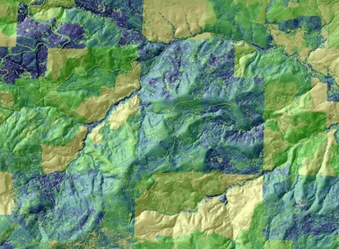
My research has examined the scale-dependency of LiDAR-derived terrain attributes in digital soil mapping. Results from this work have shown that in high relief forested ecosystems (Fig. 1c), high resolution LiDAR data (i.e., less than 5m) is too fine to approximate soil-landscape processes and that coarser scale DEM derived terrain attributes produce optimal correlations in soil-landscape models. An explicit understanding of the scale dependency of soil and related environmental attributes is thus essential in our ability to quantify how land-use and climate change may impact natural and managed lands across vast spatial extents.
Quantifying the spatial distribution of soil properties is essential for ecological and environmental modeling at the landscape scale, as well as for promoting sustainable resource management. Since approximately 60% of all U.S. forests are actively managed for timber production and forests represent the largest terrestrial C sink, understanding how forest management practices (i.e., fertilization, clear-cutting, prescribed burns) influence soil carbon cycling and storage is critical. My research is also examining the use of chemometric modeling using mid-infrared spectroscopy as an inexpensive, high-throughput method for predicting soil properties. When implemented in a spatially-explicit way, chemometric modeling may be integrated with soil-landscape modeling techniques, allowing for accurate prediction of soil properties and classes across landscapes.
The frequency and severity of drought is expected to increase in the 21st century as a result of climate change. Understanding the timing, duration and spatial extent of prolonged periods of drought is important in managing and sustaining the ecological structure and function of managed ecosystems. The U.S. Bureau of Land Management (BLM) manages approximately 70 million ha of public lands within the continental U.S. BLM lands are managed for multiple uses (e.g., livestock grazing, recreation, timber harvesting), with each land-use having different potential ecological impacts in responses to drought. Additionally, the severity of drought across a landscape varies in response to landscape heterogeneity, thus creating even greater spatial and temporal variability in how individual land-uses may impact ecosystem function. Consequently, there is a critical need to develop a spatially-explicit drought monitoring framework that provides near real-time information at spatial scales relevant to land management decisions. My research has developed a modeling framework that uses freely available MODIS satellite imagery to calculate the drought severity index (DSI) at a 1 km spatial resolution and 16-day temporal resolution across 70 million ha of BLM managed lands between the years 2000 and 2014. This DSI time series was analyzed using a near real-time disturbance monitoring approach based on a Breaks For Additive Seasonal and Trend (BFAST) model. The BFAST-type season-trend model automatically identified and modeled stable historical variation within each pixel time series from 2000 to 2009. Newly acquired data (2009-present) was then evaluated relative to this stable baseline, with significant positive (wetter) or negative (drier) deviations identified. Results from several drought-prone areas were evaluated using field-based soil moisture data. This approach quantified both the magnitude and date of significant change, providing land managers with spatially explicit near real-time information on drought condition that can help direct management actions to minimize land-use impacts.